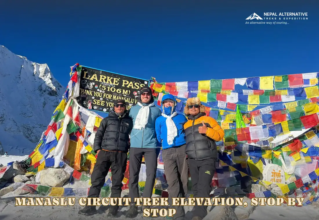
The Manaslu Circuit Trek starts at 870 m in Machha Khola and reaches its highest point at Larkya La Pass, 5,106 m above sea level. You cross the pass during the trek, but you do not sleep there. The highest overnight stop on the route is Dharmashala at 4,460 m. After crossing the pass, you descend to Bhimthang at around 3,720 m.
These Manaslu Circuit Trek elevations help you understand what makes the Manaslu Circuit Trek challenging. The walk starts in a warm river valley, spends several nights between 3,000 m, then makes one long push over the pass. A longer itinerary can include acclimatization days in Sama Gaun and Samdo, which gives you more time to adjust before reaching the highest part of the trek.
The Manaslu Circuit is a full route around Mount Manaslu, not a trek to the mountain’s base camp and back. This guide explains the elevation at each main stop, how the trail gains height, where you sleep at the highest altitude, and why the number of days matters when planning your trek.
Manaslu Circuit Trek Elevation Chart
The chart below lists the approximate elevations of the main stops and some extra overnight options used on longer itineraries. Elevations can vary slightly between maps and trekking company itineraries.
| Stop | Elevation | Role |
|---|---|---|
| Machha Khola | 870 m | Common starting point after the drive |
| Dovan | 1,070 m | Extra overnight stop on some slower itineraries |
| Jagat | 1,410 m | Common entry point to the restricted area |
| Deng | 1,960 m | Village in the lower Budhi Gandaki valley |
| Chisapani | 2,215 m | Extra overnight stop on some itineraries |
| Bhi | 2,130 m | A drop after Chisapani |
| Namrung | 2,660 m | Gateway to the Nubri villages |
| Lho | 3,100 m | First overnight stop above 3,000 m |
| Sama Gaun | 3,530 m | Main acclimatization stop before Samdo |
| Samdo | 3,780 m | Last village before Dharmashala |
| Dharmashala | 4,460 m | Highest overnight stop |
| Larkya La Pass | 5,106 m | Highest point, not an overnight stop |
| Bhimthang | 3,720 m | First overnight stop after the pass |
| Tilje | 2,300 m | Common final walking stop before the road journey |
How the Manaslu Circuit Route Gains Elevation
The Manaslu trek trail follows the Budhi Gandaki River upstream, passes through villages in the Manaslu region, crosses Larkya La Pass, and descends toward Dharapani on the Annapurna side. Mount Manaslu rises to 8,163 m, but the trekking route circles the mountain rather than climbing it.
The trek begins at Machha Khola after driving from Kathmandu. From there, the route passes through Jagat, Deng, Namrung, Lho, Sama Gaun, and Samdo. The trail then reaches Dharmashala before the pass crossing and the descent to Bhimthang.
Trekking days involve 5 to 7 hours of walking each day. The pass day is longer, often taking 8 to 10 hours or more in difficult weather. The route is not a technical climb, but it is a remote, high-altitude trek with a long crossing day.
A shorter Manaslu Circuit trek itinerary takes around 12 days when the road allows trekkers to start farther up the valley and rest days are limited. Other longer plans take 14 to 18 days when they include slower walking stages and extra time for acclimatization.
Overnight Elevation Gains
The highest point is only part of the elevation story. The height where you sleep each night matters too, especially as the route climbs above 3,000 m.
| Change in overnight stop | Approximate elevation change |
| Machha Khola to Jagat | +540 m |
| Deng to Namrung | +700 m |
| Lho to Sama Gaun | +430 m |
| Sama Gaun to Samdo | +250 m |
| Samdo to Dharmashala | +680 m |
| Dharmashala to Bhimthang | -740 m |
Elevation From Machha Khola to Deng
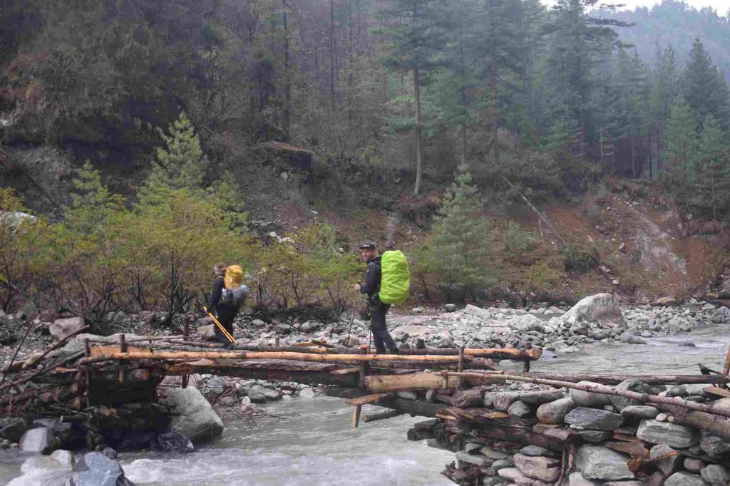
The trek begins in a river valley, not in alpine terrain. From Machha Khola, the trail follows the Budhi Gandaki River and crosses suspension bridges. The route climbs and descends in stages rather than gaining height in one steady line.
Jagat, at about 1,410 m, is a key checkpoint for the restricted-area section. Army check your permits here. From Jagat, the trail then continues through the lower villages and past Philim, where you pass a Manaslu Conservation Area checkpoint, then reaches Deng at about 1,960 m.
Some longer itineraries divide this section (from Machha Khola to Deng) into shorter days. Dovan, Chisapani, and Bhi may be used as overnight stops, depending on the road access and the route plan. Note that the trail does not climb every day. For example, Bhi is lower than Chisapani, so an elevation chart should show the drop as well as the climbs.
The landscape in this section includes forest, river views, and villages with traditional stone and mud houses. Rhododendron, oak, and pine grow in parts of the valley. At these lower elevations, the climate is generally warmer than it is in the villages near the pass.
Elevation from Namrung to Sama Gaun
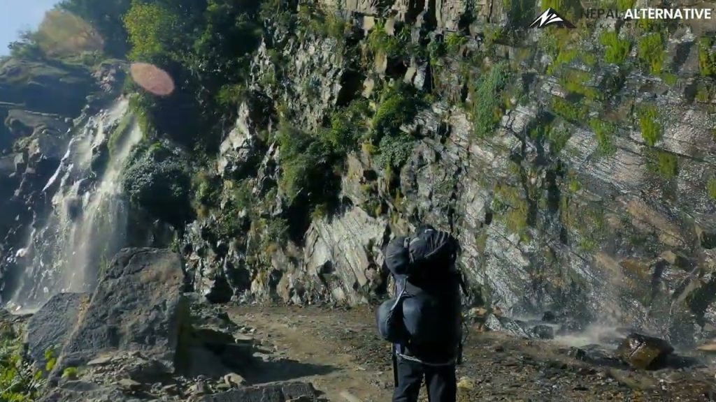
Namrung, about 2,660 m, is the shift into the Nubri villages. Mani walls and chortens become common. The Manaslu region here is culturally Tibetan Buddhist, even though the walk began among Gurung and Magar settlements lower down.
Lho, at about 3,100 m, is the first common overnight stop above 3,000 m. The change in altitude may become noticeable here, especially if you have climbed quickly from the lower valley. A trek that reaches Lho early in the itinerary may feel manageable on the trail, but it still gives your body limited time to adjust to the higher sleeping altitude.
Sama Gaun, at around 3,530 m, is the first and most important acclimatization stop. A cautious itinerary plans a full rest day here. Some trekkers take a walk to a higher point and return to sleep in the village, following the general principle of climbing higher during the day and sleeping lower at night.
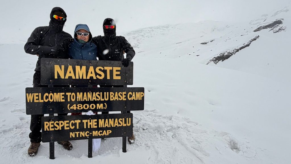
For the acclimatization hike, Birendra Lake is a lower-key option, while Manaslu Base Camp is a much higher, more demanding acclimatization hike. Manaslu Base Camp at 4,800 m is a possible side hike from Sama Gaun for trekkers who are properly acclimatized and feel well. It is not an activity that every trekker needs to complete. Pungen Gompa, also written Pungyen Gompa, is another cultural stop near Sama Gaun. It can be a good option when conditions are suitable, and the group wants a shorter visit rather than a demanding altitude hike.
Elevation From Samdo to Dharmashala
Samdo sits at around 3,780 m and is the last main village before the high camp at Dharmashala. The landscape becomes more open and dry, with less forest than in the lower valley. And since the route is now above 3,500 m, how you feel and how well you have acclimatized become especially important.
A second acclimatization day in Samdo gives you more time before the pass. The acclimatization hike includes a day hike toward Samdo Ri or Rui La. Any such outing should be planned with a guide and should return to Samdo for the night. A high viewpoint is not a suitable place to sleep.
Dharmashala, also known as Larke Phedi, is around 4,460 m. It is a basic high camp rather than a large village. Accommodation is limited, and rooms or shared sleeping spaces can fill up during busy trekking periods. Pass crossings usually start before dawn, so trekkers generally eat early and prepare their gear the evening before.
The climb from Samdo at 3,780 m to Dharmashala at 4,460 m raises the sleeping altitude by about 680 m. This is a substantial change. It is one reason to keep the acclimatization days in the itinerary rather than treating them as optional time that can be removed.
Larkya La Pass Day
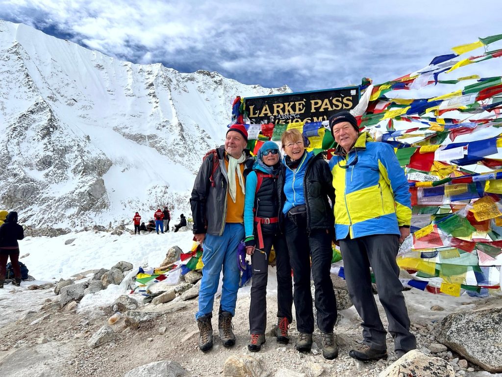
Larkya La Pass is the highest point of the Manaslu Circuit Trek at 5,106 m. You leave Dharmashala in the dark and begin the long climb toward the pass. Depending on the season, the trail may include loose rock, snow, or ice.
The elevation difference between Dharmashala at 4,460 m and the pass at 5,106 m is about 646 m. After reaching the pass, the route descends to Bhimthang at 3,720 m. That is a drop of about 1,386 m from the pass, so the descent can be hard on tired legs and knees.
The pass day often takes 8 to 10 hours, but it can take longer in difficult weather or when the group moves slowly. Trekking poles can help on the descent. Microspikes may be useful in icy shoulder-season conditions, while winter conditions can require more technical equipment and may make the pass unsafe or closed. Ask your guide about current trail conditions before setting out.
On a clear day, views may include Mount Manaslu, Himalchuli, Himlung Himal, and Annapurna II, along with other surrounding peaks. Clouds can hide the views, and snow or strong winds can make the crossing harder. Reaching the pass safely matters more than the photographs.
After the Pass: Bhimthang to Tilje
After crossing Larkya La, the trail descends to Bhimthang at 3,720 m. This is still a high overnight stop, but it is much lower than the pass and Dharmashala. After the long crossing, you benefit from a quiet evening and a chance to recover. Ponkar Lake is a possible side trip from Bhimthang if you have extra time and enough energy. If you are exhausted after the pass, it is fine to skip the side trip.
The route continues down toward Tilje at around 2,300 m. From there, road transport can take you toward Besisahar and Kathmandu, depending on road conditions and the arrangement made by your trekking agency. Dharapani, at around 1,990 m on some itineraries, is an important point where the trail meets the Annapurna region, but it is not always listed as an overnight stop.
This is what makes the Manaslu Circuit a circuit trek. You do not return down the Budhi Gandaki Valley. After crossing the pass, you descend into a different valley and leave the route on the Annapurna side.
Is a 12-Day or 14-Day Manaslu Circuit Trek Better?
The main difference between a shorter and a longer Manaslu Circuit itinerary is not the height of Larkya La Pass. The pass remains at 5,106 m. The difference is how quickly you reach the high sleeping elevations and whether the itinerary includes enough time to acclimatize.
A compressed plan may include only one main acclimatization day, often in Sama Gaun. A longer plan can include an extra rest day in Samdo and shorter walking stages in the lower valley. A longer itinerary takes 14 to 18 days for the Manaslu Circuit Trek, especially when road access, side trips, or a slower pace add time.
Consider a longer itinerary if this is your first trek above 4,000 m, if your previous hikes were shorter, or if you have needed extra time to adjust to altitude in the past. In contrast, a shorter itinerary is not wrong for every experienced trekker, but it leaves less room to respond to symptoms, bad weather, or delays.
Nonetheless, don’t choose a trek only because it has fewer days or costs less. Ask where you will sleep each night, how many nights are above 3,500 m, and what the guide will do if someone feels unwell at Samdo or Dharmashala.
There is also a much longer link. A Tsum Valley trek before the circuit, or a continuation over Thorong La on the Annapurna Circuit Trek, turns this into a multi-week route. This trip needs separate planning. They do not change the elevation of Larkya La Pass.
Manaslu Circuit Trek Difficulty
Trekking companies describe the Manaslu Circuit as moderate, strenuous, or challenging. These labels are not fully consistent, so it is more useful to look at the actual demands of the route.
You should be prepared for walking days of around 5 to 7 hours, a much longer day over Larkya La, nights above 3,500 m, and a basic overnight stop at 4,460 m. The descent from the pass is long and can be tiring, especially if the trail is snowy or loose.
The trek can also be harder to organize than routes with more road access and more frequent services. The Manaslu region is remote, accommodation is limited in some places, and the pass can be affected by weather. A guide and lodge may be your main local support for long stretches of the route.
Previous trekking experience helps you understand how your body responds to long days and changing elevation. Trekkers who have completed routes such as the Annapurna Base Camp trek may have a better idea of their walking pace, but that experience does not guarantee that the Manaslu Circuit will feel easy.
Altitude Sickness on the Manaslu Circuit Trek
Altitude sickness can begin before you reach the pass. Common symptoms of altitude sickness include headache, nausea, unusual tiredness, loss of appetite, dizziness, and poor sleep. Some people may become unusually quiet or irritable rather than clearly explaining how they feel.
The acute mountain sickness risk increases as sleeping elevations rise, particularly above 3,000 m and again above 4,000 m. Lho is the first main overnight stop above 3,000 m, while Dharmashala is the highest night on the usual route. Do not assume that a person is simply tired if they develop symptoms at these elevations.
If symptoms appear, do not continue to a higher elevation until you have assessed the situation and obtained appropriate advice. Worsening symptoms require descent and urgent medical attention. A bad headache at Dharmashala is not something to ignore just to cross the pass at dawn.
Keep the acclimatization days in the itinerary. A side hike to Manaslu Base Camp or toward Samdo Ri should only be considered when the trekker feels well and can return to sleep at the lower village. Do not combine a demanding side hike with the pass day.
Manaslu Circuit Trek Permits and Guide Requirements
The Manaslu region between Jagat and Dharapani is a restricted area trek. A licensed guide, booked through a trekking agency, is required. From 22 March 2026, only one person can hold a permit. However, that person still cannot walk the restricted section alone. An experienced guide is part of the rule, not an optional comfort. Similarly, one trek guide can lead a limited group. Recent notices cap that group at seven trekkers.
The permits required for trekking to Manaslu Circuit include:
- Manaslu Restricted Area Permit: Required for the restricted section, commonly counted from Jagat. Price differs based on the season. From September to November (peak season), it’s USD 100 for the first 7 days, plus USD 15 per additional day. From December to August (off-season), it’s USD 75 for the first 7 days, plus USD 10 per additional day. It’s issued via the Department of Immigration in Kathmandu through your agency.
- Manaslu Conservation Area Permit: It’s checked around Philim. It costs NPR 3,000 for foreign nationals and NPR 1,000 for SAARC nationals.
- Annapurna Conservation Area Permit: Required on the Annapurna side after the pass. It costs NPR 3,000 for foreign nationals and NPR 1,000 for SAARC nationals.
Best Time for the Manaslu Circuit Trek and Expected Temperatures
Spring, from March to May, and autumn, from September to November, are the main trekking seasons for the Manaslu Circuit. Conditions vary from year to year, but these periods often offer more suitable weather for the pass crossing.
In autumn, lower parts of the route can feel mild during the day, while nights become colder as you climb. Above 3,000 m, temperatures can drop below freezing at night. Before dawn on the pass day, you should be ready for very cold conditions.
Temperature estimates differ between weather summaries and climate tables. Rather than relying on a single range, pack for freezing temperatures at Dharmashala and on the pass, even if the lower valley feels warm.
The monsoon season, roughly June to August, brings rain to the lower trail and can reduce visibility. Winter can bring heavy snow and ice around Larkya La, and the pass may become unsafe or close. Neither season should be treated as an easy alternative to a spring or autumn trek.
Keep a buffer day in Kathmandu when possible. It will not change the elevation of the trek, but it can help protect your travel plans if a road transfer or flight is delayed.
Conclusion
The Manaslu Circuit elevation chart is most useful when you read it alongside the overnight itinerary. The highest point is important, but the height where you sleep and the speed at which you gain altitude also affect how demanding this high altitude trek will feel.
The lower Manaslu Circuit trail includes climbs and descents, so the route does not rise in a straight line. Above Namrung, the sleeping elevations increase. Sama Gaun and Samdo provide important opportunities to rest before Dharmashala and the pass crossing.
Before booking, ask your trekking agency three questions: Where is the highest overnight stop? How many nights will you sleep above 3,500 m? What happens if you need an extra rest day or cannot continue from Samdo?
Do not compare treks by the headline day count alone. The pass remains at 5,106 m whether you take a shorter or longer route, but a well-planned schedule gives you more room to adjust to the altitude and changing conditions.